MENVIPRO Summer School: GIS and Remote Sensing Technologies
September 23, 2021
The last two days of MENVIPRO summer school were devoted to GIS and remote sensing technologies. Thus, Prof. Raffaele Casa presented the physical and technological principles of remote sensing, currently existing satellite platforms suitable for precision agriculture, application of remote sensing to the monitoring of agricultural crops and application of remote sensing to agricultural soil monitoring.
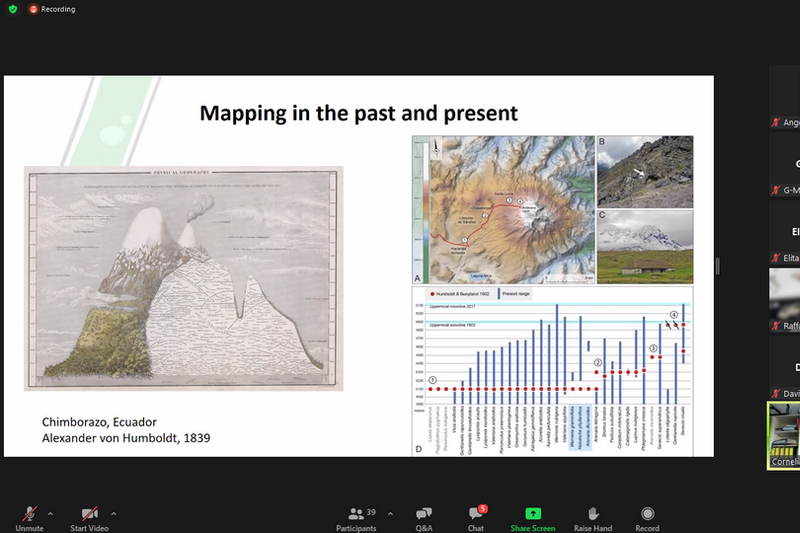
Prof. Cornelia Glässer gave the short overview about environmental remote sensing in different spatial and temporal scales and under different regional aspects. The topics were related to soil, water and vegetation as well as natural hazards. The examples showed application from assessment to monitoring of environmental impacts up to scenarios of future development using a large variety of different remote sensing data. The overall goal was to understand the potential of remote sensing data in different environmental context.
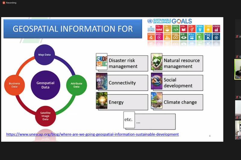
Dr. Shushanik Asmaryan introduced the main components of spatial data infrastructure, global spatial data repositories, giving the main skills how to use them. Students were introduced to the main structural components of the spatial data infrastructures, software, global data repositories and the benefits of their application, as well as they were introduced the standards, the experience of creating the nationally distributed processing capacities for geospatial data in Armenia as well as the benefits of geospatial data and metadata sharing and exchange.
Dr. Michael Denk spoke about a variety of freely available global Digital Elevation Models (DEM) providing manifold analytical possibilities for different fields of research. The session provided a brief introduction to DEM and gave an overview of global elevation data sets. The main part addressed the derivation of terrain parameters and different visualization approaches utilising the open source Geographical Information System QGIS and freely available digital elevation data. His second lecture was about multispectral satellite imagery offering powerful capabilities for land cover mapping and qualitative and quantitative analyses of Earth surface. The aim of the session was to provide an introduction to land cover mapping and analysis using open source software and freely available Sentinel-2 data. The session offered insights in selected techniques for image visualisation, interpretation and analyses.